
The Inca Trail is the best hiking trips to Machu Picchu and one of the most remarkable achievements of the golden age of the Inca and Pre-Inca civilization and perhaps its greatest mystery is Machu Picchu. Each year it is the goal for an increasing number of visitors but few make the journey along the ancient Inca Trail which is a part of a network of at least 30,000 km. of main paved highways that the Inca built along the Empire. The roads were tremendous feats of engineering and so well constructed that large sections still survive despite centuries of neglect.
One of the best-known stretches of this imperial highway system remaining today is the route known as the Inca Trail to Machu Picchu.
The Inca Trail trek begins at Kilometer 82 near Ollantaytambo in the Urubamba Valley and goes through small woods, bamboo forests, subtropical vegetation and wild orchards.
The trail runs about 43 km, beginning at Qoriwayrachina, popularly known as km 88 on the Cuzco route climbing steadily up to Huallabamba, there it continues to the Llullucha Pampa until it reaches the pass of Warmiwañusca at 4,200 ms. Then the trail drops into the Pacaymayo Valley and you go across two more high passes before finally reaching the ruin of Machu Picchu
The trail goes through several Inca ruins such as Llaqtapata, Runkuraqay, Sayacmarca, Phuyupatamarca, and Wiñay Wayna; traveler's camping areas, tunnels and winds throughout some of the most beautiful scenery.
The trek to Machu Picchu is completed when you arrive at Inti Punku, the Sun Gate. It is the entrance from the Inca Trail and overlooks this ancient citadel. A chance to visit the lost city of the Incas along the ancient trail.
Inca Trail trek to the Sacred Valley site begins either at km 82, Piscacucho, or at km 88, Qorihuayrachina, at 2600 m. In order to reach Km 82 hikers are transported by their tour operator in a minibus on the road that goes to Quillabamba. From Piri onward the road follows the riverbank and ends at km 82, where there is a bridge. You can depart as early as you like and arrive at km 82 faster than going by train. The Inca Trail equipment, food, fuel and field personnel reach km 82 (depending on the tour operator's logistics) for the Sernarp staff to weigh each bundle before the group arrives. When several groups are leaving on the same day, it is more convenient to arrive early. Km 88 can only be reached by train , subject to schedule and baggage limitations. The train is slower than bus, but you start your walk nearer to Llaptapata and Huayllabamba.
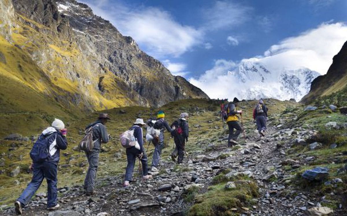
The walk to Huayllabamba, following the Cusichaca river, needs about 3 hours. Beyond Huayllabamba, a popular camping spot for Inca Trail tour groups, there is a camping place about an hour ahead, at Llulluchayoc (3,200 m). A punishing 1hr 30 min climb further is Llulluchapampa, is an ideal meadow for camping. If you have the energy to reach this point, it will make the second day easier because the next stage, the ascent to the first pass, Warmiwañusca (Dead Woman's Pass) at 4200 m. is exhausting 2 hrs 30 min.
Afterwards there is a steep path dowhill to the Pacamayo valley. Beware of slipping on the Inca steps after rain. You could camp by a stream at the bottom (1 hr 30 min from the first pass). It is no longer permited to camp at Runkuracay, on the way up to the second pass (a much easier climb 3,850 m). Magnificent views near the summit in clear weather. A good overnight place is about 30 min past the Inca Ruins at Sayacmarca (3,500 m), about an hour on after the top of the second pass.
A gentle 2 hrs climn on a fine stone highway leads through an Inca tunnel to the third pass. Near the top there's a spectacular view of the entire Vilcabamba range.
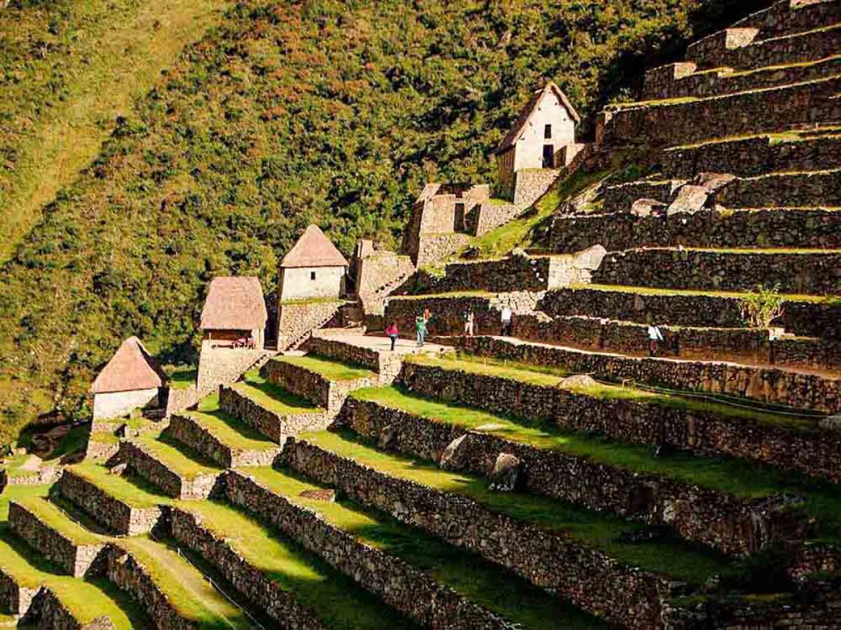
You descend to Inca ruins at Phuyupatamarca (3,650 m), well worth a long visit, even camping overnight. There is a 'bathroom' here where water can be collected (but purify it before drinking).
From there steps go downhill to the ruins of WiñayWayna (2,700 m), with views of the recently cleared terraces of Intipata. Access is possible, but the trail is not easily visible. There is a small campsite. After WiñayWayna there is no water and no camping till Machu Picchu.
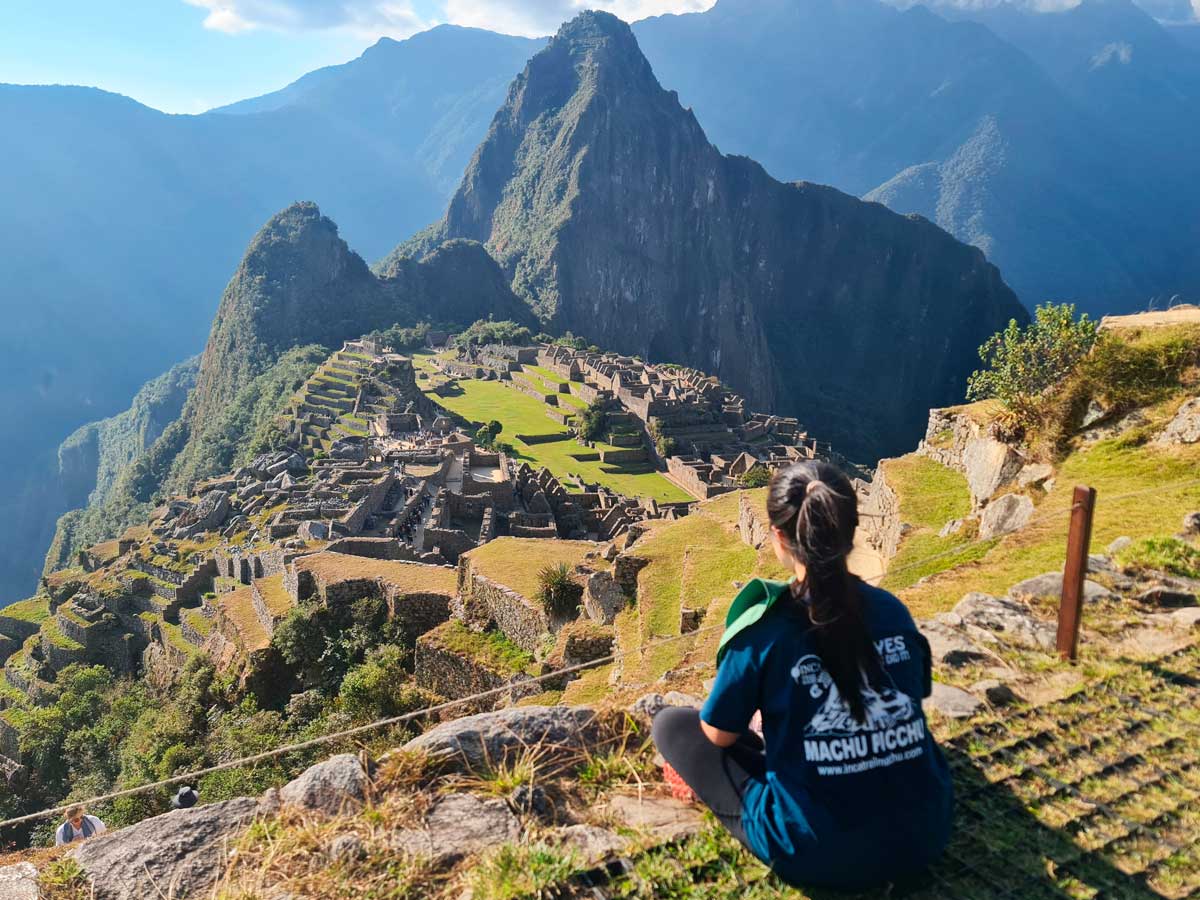
The Inca Path from this point goes more or less level through jungle until the steep staircase up to the Inti Punku (2 hrs), where there's a magnificent view Machu Picchu, especially at dawn, with the sun alternately in and out, clouds sometimes obscurring the ruins, sometimes leaving them clear.
Get to Machu Picchu as early as possible, preferably before 08:30 for best views but in any case before the tourist train arrives at 10.30.
Daily departures Inca Trail are available along the year. However, as previously stated the high season (June-September), bookings need to be 4-6 months ahead of your travel dates. The exception is one-month closing period of all Inca Trail routes in February.This is the month for total maintenance of the trail. All Inca Trail departures are subject to government space availability, please check the following website: Ministerio de Cultura > Consultas > Centro Arqueológico: please select Camino Inca > Please select year and month. The Inca Trail books up quickly, so when you decide on checking this adventure off your list, get online at the official website www.machupicchu.gob.pe
These are companies that have received official authorization and the only allowed to operate the Inca Trail. An authorization has to be renewed each year. The authorization is granted by goverment institutions: Ministerio de Cultura, GERCETUR It´s strongly recommend you to check your Inca Trail operator authorization prior to do a booking.
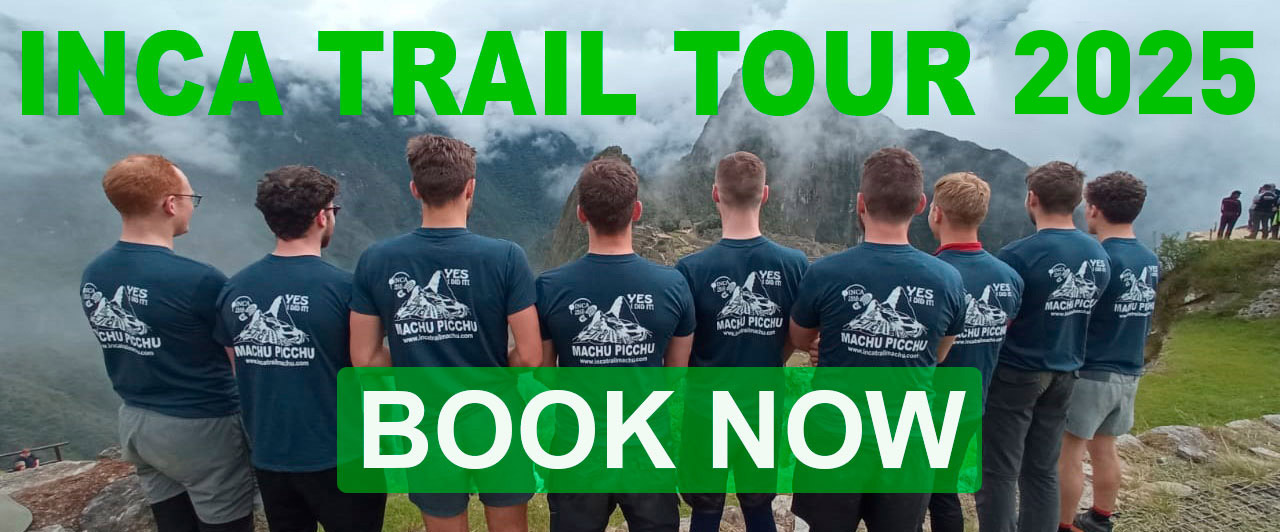
This list of the Machu Picchu hiking tours includes a whole range of different options. You can take short, crisp trips to this wonder. Or experience the full program and hike through mountainous valleys on a challenging 5-day tour, get to know the local Peruvian culture and camp under the stars along the way.
Some travelers come directly from Cusco to Machu Picchu using the railways to Aguas Calientes. Others prefer something more adventurous, which is also made possible by the challenges of the Inca Trail, carved through the Sacred Valley centuries ago.
How do you visit the lost city in the clouds?
This two-day excursion is all about complementing the pilgrimage to the Sun Gate with a trekking adventure through some stunning stretches of the Peruvian Andes. You follow in the footsteps of the Incas themselves and your hiking boots will definitely not stay clean, we can tell you that much!
As you wind your way through the mist-shrouded plains, you'll experience archeological sites like Wiñay Huayna that are hidden from most day-trippers. Your second day includes optional excursions up Machu Picchu mountain (if sore muscles allow!) and a full tour of the UNESCO World Heritage Site.
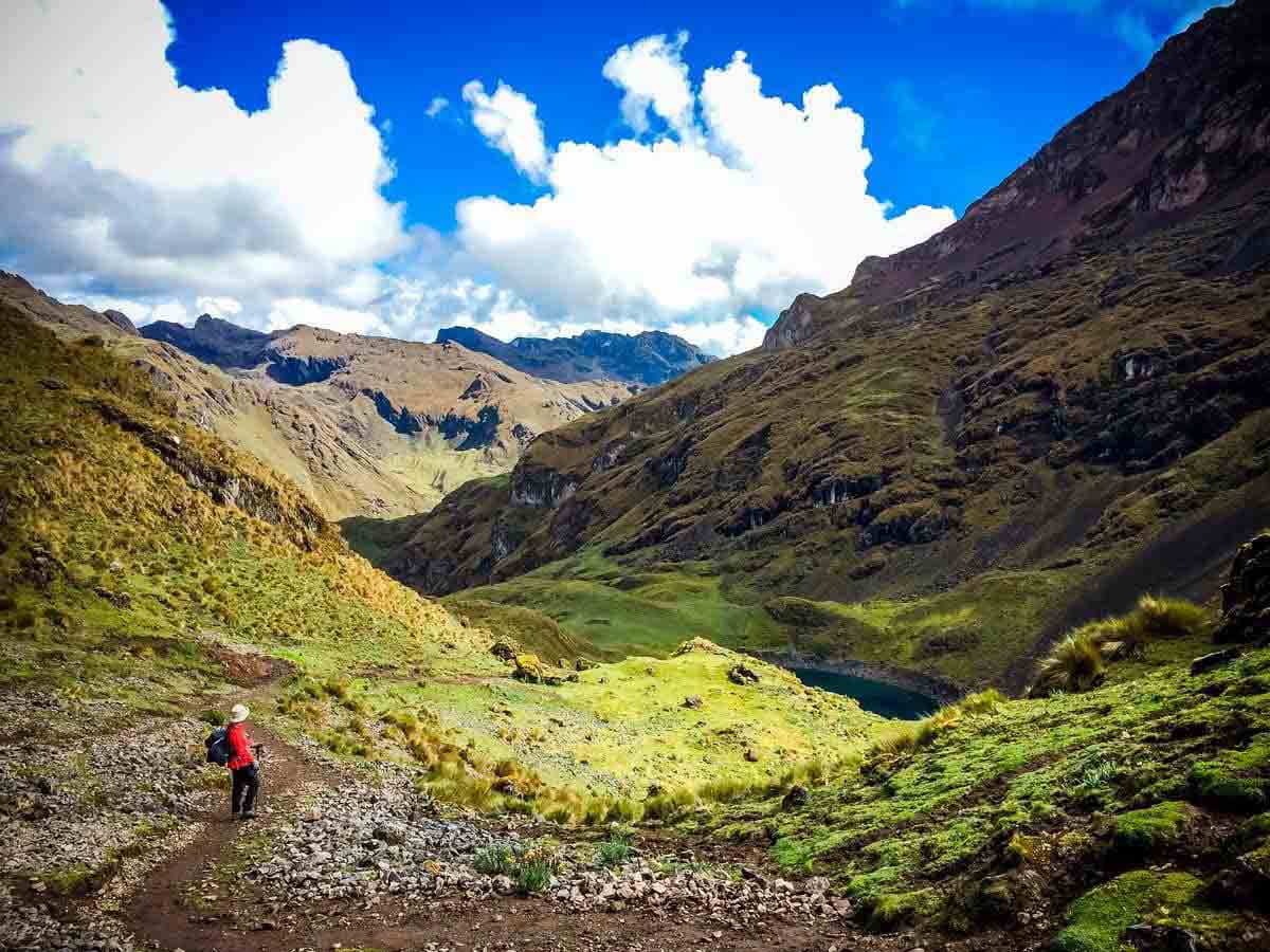
Marvel as clouds swirl through the wild Andes, snowdrifts dance on the peaks, and ancient Inca stone paths twist and meander over the hills, all during this five-day trek into historic territory. It all begins in the Mollepata Valley, where 4,900-meter mountains stand guard. Move on and you'll reach subtropical forests, taste regional dishes prepared by local chefs and even sleep under the twinkling stars at the high-altitude Collpa Bamba campsite.
Your trips to Machu Picchu only begins in the last two days of the excursion, when you embark on the Pueblo Trek, via waterfalls and bubbling rivers to Aguas Calientes. Then you have a full afternoon to explore the wonder and discover the temples and terraces.
Conquer a 58-kilometer cross-section of the Peruvian high Andes with this adventurous package. Four days of hiking from misty peak to rustic town, even camping along rushing river courses like the Apurimac.
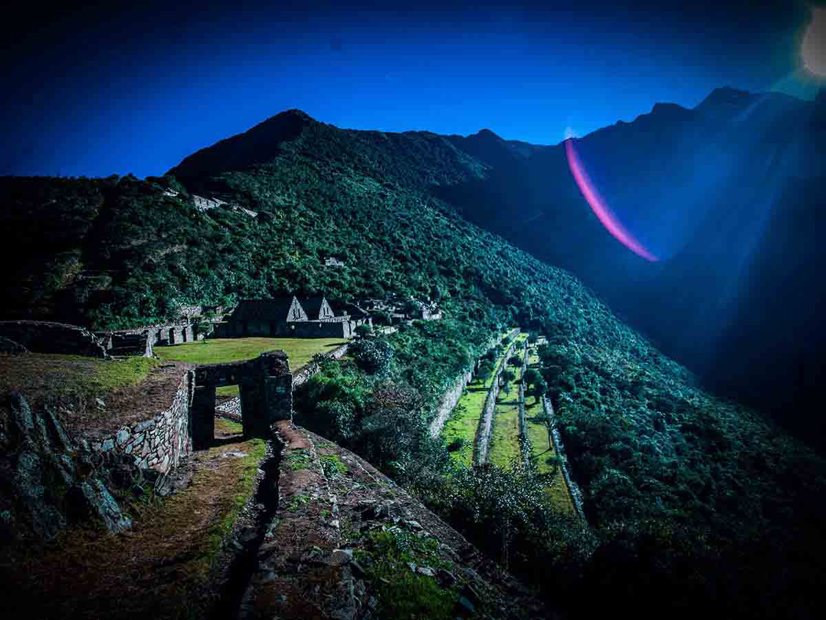
After two days of zigzagging over forested slopes and discovering gushing waterfalls between remote villages, you finally arrive at the Choquequirao ruins, characterized by their impressive agricultural terraces that jut steeply into the hills. Machu Picchu caps the end of your excursion before heading back to Cusco in urban luxury.
Bathe in the magnificent setting of the Peruvian Andes in the famous hot springs of Lares. This is what this multi-day hike through the mountains offers you. Right at the beginning, the hike to the remote Cancha Cancha turns out to be a challenge. You get a feel for the rustic life that is part of everyday life in this region.
Then it goes over the pass of Pachacutec to a whopping 4,758 meters above sea level. Hike done? Excellent. Your next stop is the stunning city of Machu Picchu itself, which unfolds on the peaks above Aguas Calientes and is only a short bus and train transfer away.
The best season is during the dry season which starts in April and ends in September. If you travel in June, we recommend you to book the Inca Trail tours and also Salkantay trek or Sacred valley to Machu Picchu that are other incredible tours located in the Andes near Cusco.
The months of June, July, and August are considered the peak season, with a higher number of visitors. If you prefer to avoid large crowds, you may consider visiting during the shoulder months of May or September when the weather is still favorable, and the trails are relatively quieter.
It's important to note that the Inca Trail is closed annually in February for maintenance, so it's advisable to plan your visit during the months when the trail is open.
 +51 84 217 551
 +51 997 434 941
 Av Tupac Amaru PP-10B, Santiago, Cusco, Peru
  info@incatrailmachu.com
 www.incatrailmachu.com


