
When the department of Puno is mentioned, Lake Titicaca is the main tourist reference. However, the region also holds other lesser-known natural attractions, among which the Tinajani Canyon stands out, located near the city of Ayaviri. This destination is a geological complex of red sandstone, known for its unique rock formations eroded by wind and water, which have created a large-scale "stone forest".
This canyon, which stands out for its landscape, is gaining popularity as an alternative stop on the Altiplano route, outside the traditional tourist circuit. Although the tour of the canyon is not a multi-day expedition, it does offer one of the most unique one-day Peru Treks , allowing exploration of its ravines and stone formations.
For many, Tinajani is a hidden gem that complements the list of Peruvian Highlights. This guide will provide the essential information on how to get to this site, what to expect from the visit, and the logistics needed for its exploration.
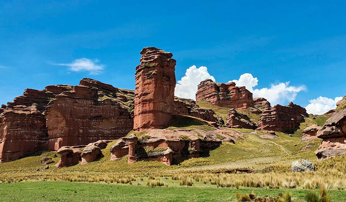
The Tinajani Canyon is a natural geological complex located at 3,953 meters above sea level, in the Puno region. It covers an area of approximately 250 hectares and is made up of three main ravines: Queñuacuyo, Pacobamba and Huarachani.
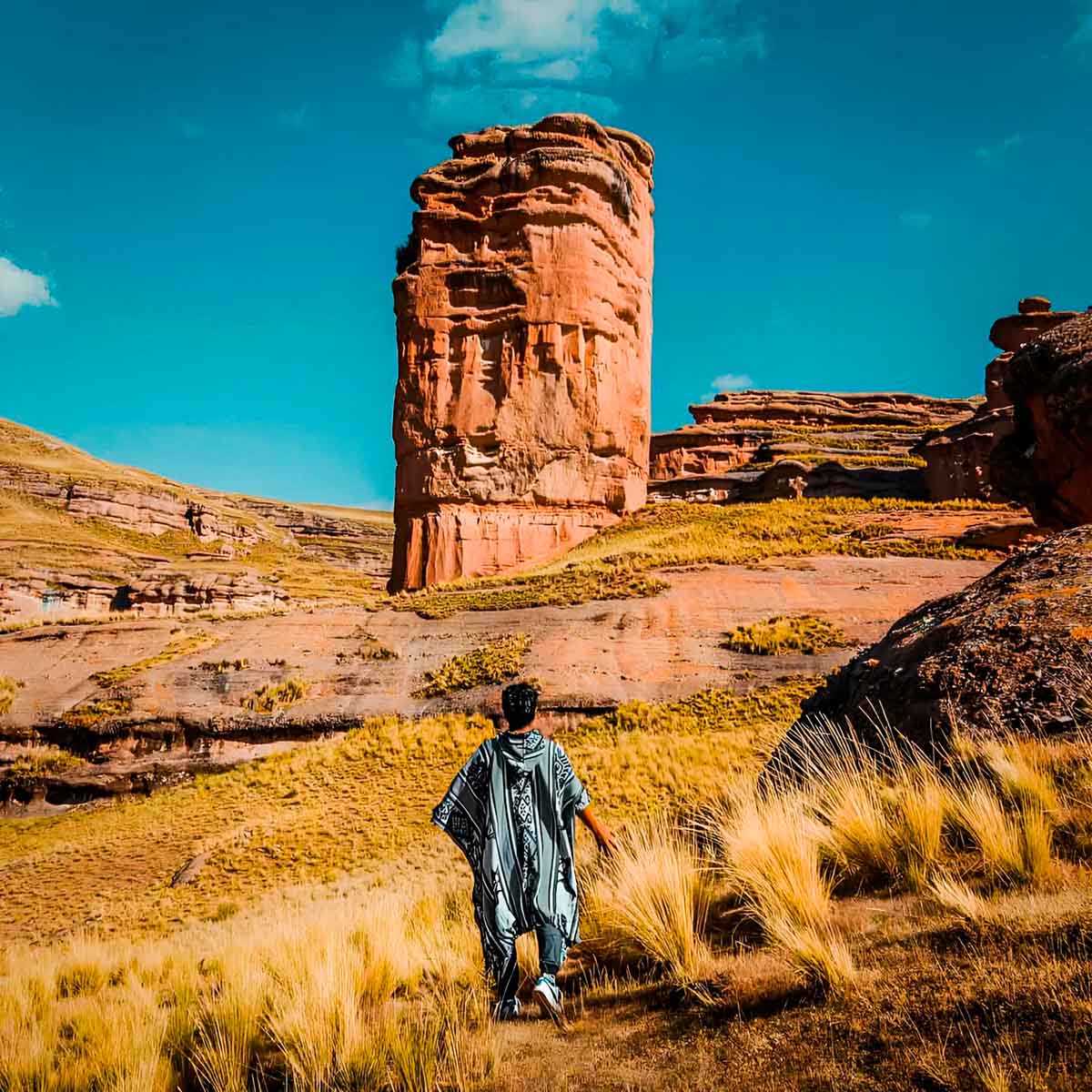
Its main feature is being a "stone forest", formed by huge red sandstone rocks that have been sculpted by the erosion of wind and water over millions of years. These rock formations, which can reach more than 50 meters in height, have taken on unique shapes that the popular imagination interprets as human figures, sphinxes and various animals.
Geologically, the area was a lake bottom millions of years ago. The accumulated sediments, combined with later volcanic activity and tectonic lifting, created this formation. Erosion has been the main sculpting force. The result is a landscape of unique rock configurations, ideal for photography and hiking. The area is also considered a destination with potential for adventure sports like rock climbing and horseback riding.
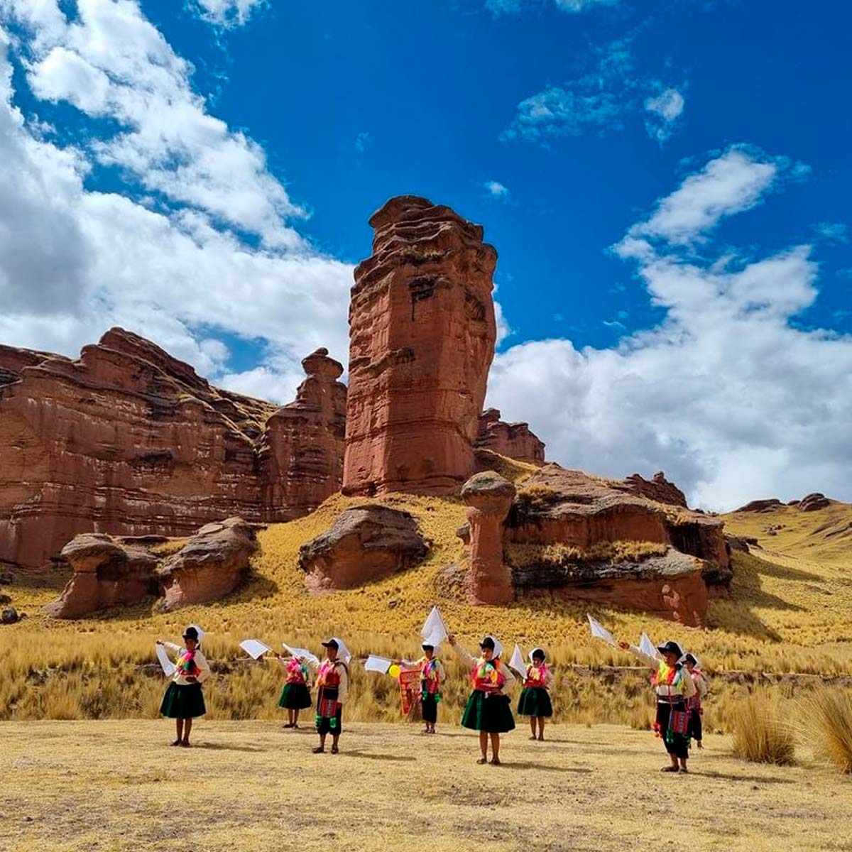
In addition to having an enviable natural wealth, it was also the territory of Quechua-speaking inhabitants of the Qaluyo culture. This population was settled in the valley of the Pacobamba River, which is very close to Tinajani. What can be seen of this culture are the tombs and chullpas that are still found within the territory of the Canyon.
Thanks to residents who still participate interacting with the Canyon, very popular traditions and festivities are maintained. Thus, in July the Music and Dance Festival is held at the foot of the Tinajani. This event brings together not only hundreds of dancers from all over the region, but also national and foreign visitors who come with the desire to see the culture of the highlands in action.
Scientific studies have revealed that, in ancient times, this place was the bottom of a huge lake and that its rock formations are the product of the work of water and wind. However, as in all places in Peru, the Tinajani Canyon Puno has several legends about its origin that give the place a more magical touch.
One of them says that the Inca Pachacútec was worried about the great drought that devastated this region of our country. To find out where this drought came from, he consulted fortune-tellers, who told him that it was the product of the devil, who was walking around these places. To put an end to this situation, Pachacútec ordered the creation of three stone jars, which would serve the devil to purify himself and leave the place. However, many say that the devil is still present in the Tinajani Canyon and that it resounds on rainy nights.
Another of the legends about this place is the one that tells that, many years ago, there was neither sun nor moon and the canyon was inhabited by giant men, who made their lives in it. But the day the sun came up, the giants were completely petrified and turned into these huge rock formations that we can now see.
The Tinajani Canyon is a natural complex whose main attraction is its geological formations. The site is made up of towering cliffs and isolated sandstone rocks, eroded into unique shapes that reach considerable heights. The characteristic reddish color of the rock dominates the landscape.
The canyon is divided into three main ravines, through which the Pacobamba River flows, a calm watercourse that complements the geological surroundings. The area offers hiking trails that allow you to explore these rock formations up close and appreciate the scale of the high plateau landscape.
 |  |
The Tinajani Canyon is located 150 km north of Puno and 4059 meters above sea level.
To get here, you will have to travel to the city of Ayaviri, from where the detour to the canyon leaves. The section between Ayaviri and the canyon is only 14 kilometers long, which you can do by transport or on foot, since it is a flat terrain perfect for a simple walk.
After your visit to the canyon, we recommend you make a stop at Ayaviri, where you can recharge your batteries with a delicious cancacho: a typical local dish made with roasted and macerated lamb meat. A perfect closure for your visit to the Tinajani Canyon Peru!
The Extra Tip
The temperature of the Canyon ranges from 19°C to -2°C, so it is recommended that when you go to visit you wear warm clothes and also a light polo shirt. The ideal season, likewise, is between April and October.

Peru offers fascinating experiences that reveal natural landscapes, historical monuments, and living cultures, captivating those who seek adventure and discovery in every corner of its territory. Get to know the most outstanding tours:
Other trips in Peru
If you want to visit Machu Picchu, we recommend you to book your Machu Picchu Entrance Tickets in advance, so you will enjoy your Vacation in Machu Picchu without any problem.
 +51 84 217 551
 +51 997 434 941
 Av Tupac Amaru PP-10B, Santiago, Cusco, Peru
  info@incatrailmachu.com
 www.incatrailmachu.com


