
What makes a small country on the map have so many different landscapes? Peru mixes three completely different natural regions: the Pacific desert coast, the Andean mountains, and the Amazon jungle, which covers about 60% of the national territory. This mix allows you to travel, in a matter of days, through a coastal desert, a city at more than 3,000 meters high, and a tropical nature reserve, without leaving the same country.
In the center of this variety is Machu Picchu, the Inca citadel declared a World Heritage Site by UNESCO in 1983 and chosen as one of the New Seven Wonders of the World. But is Machu Picchu the only reason to travel to Peru? Around this citadel there is a network of destinations that many travelers overlook when planning their trip: valleys, mountains, lakes and deep canyons, each reachable from Cusco or Lima.
This guide goes through the destinations you should consider when planning a trip to Peru, from the most visited to some less known ones. And it answers questions like: How much time do you need to see the essentials? Is it worth leaving the classic Cusco-Machu Picchu route?
Peru focuses most of its tourist attractions in two regions: the southern Andes, with Cusco as a starting point, and the Amazon, reachable from Lima or Puerto Maldonado. Most first-time travelers plan their trip around Cusco, because from there you can reach Machu Picchu, the Sacred Valley, and trekking routes like the Inca Trail or the Salkantay in a few hours. Next, we will get to know the best places to visit in Peru:
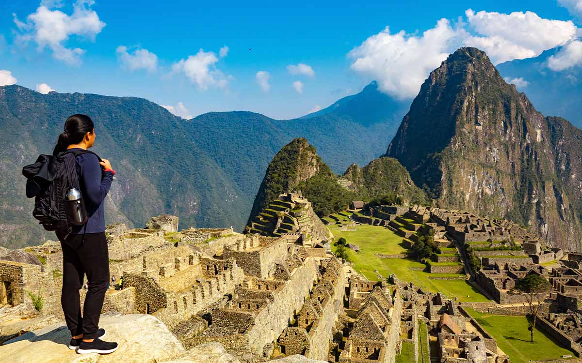
Machu Picchu is an Inca citadel built in the 15th century, located at 2,430 meters above sea level, in the Urubamba province, Cusco region.
You can get there by train from Cusco, Ollantaytambo, or Poroy to Aguas Calientes, followed by a bus to the sanctuary entrance, or on foot through multi-day trekking routes, like the classic Inca Trail. Access is controlled by circuits with a set entry time and limited daily spots, so booking in advance is necessary, especially in high season (May to August).
Inside the site, there are two main areas:
For those looking for a panoramic view of the full citadel, there are two mountains to visit: Huayna Picchu and Machu Picchu Mountain, both with limited spots and sold separately from the main ticket.
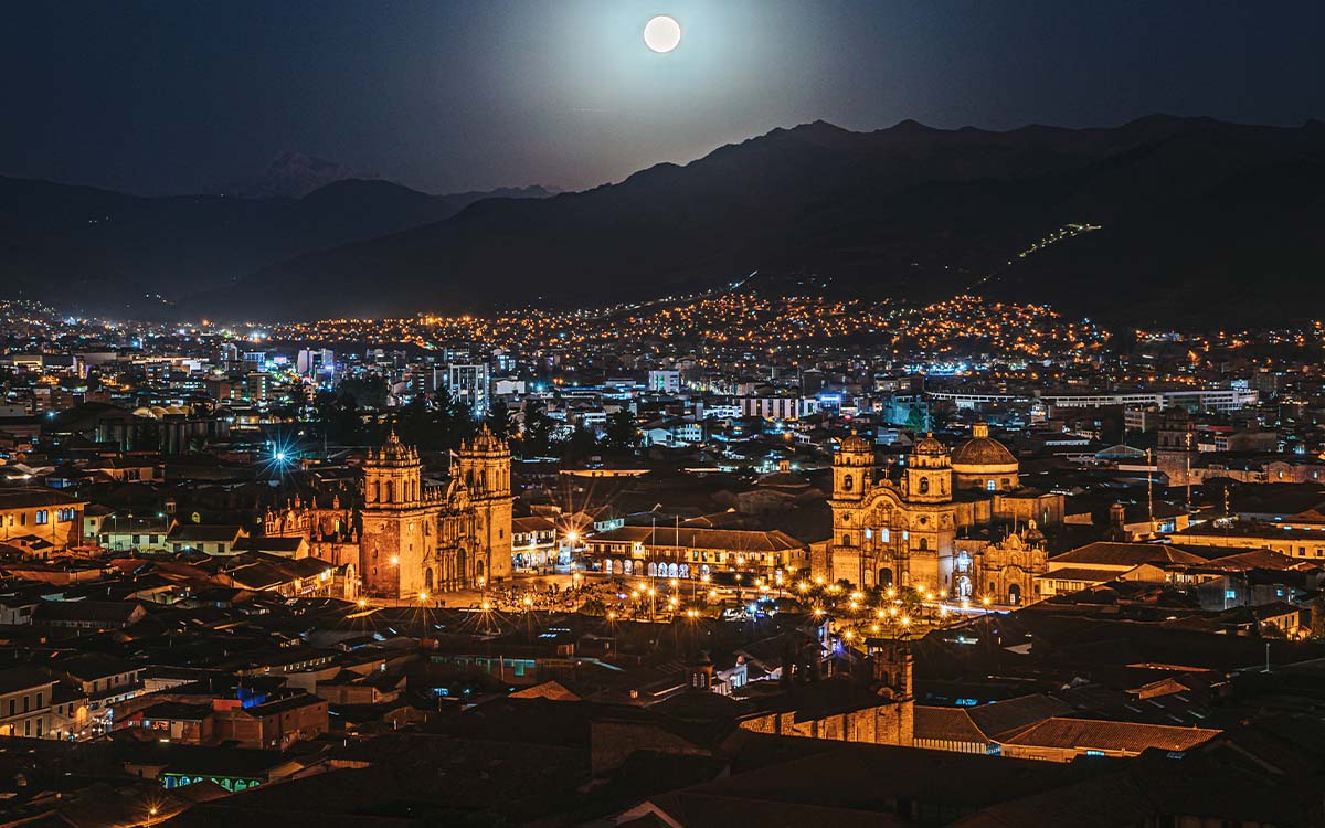
Cusco was the capital of the Inca Empire and today is a city of almost 400,000 people, a mandatory starting point to reach Machu Picchu and the Sacred Valley. Its historic center combines Inca buildings of carved stone, with Spanish colonial architecture built on those same bases, visible in the Main Square and in temples like the Cusco Cathedral.
The city is located at 3,399 meters of altitude, so many travelers spend one or two days getting used to the altitude before continuing to higher areas, like the Sacred Valley or the Inca Trail.
Every June 24, Cusco celebrates Inti Raymi, the Festival of the Sun, a recreation of the Inca ritual giving thanks to the god Inti. The main ceremony takes place on the Sacsayhuaman esplanade, with hundreds of local actors in traditional clothes, it is one of the most crowded cultural events in the Peruvian tourist calendar, besides the Corpus Christi patronal festival, celebrated weeks before in the same city.
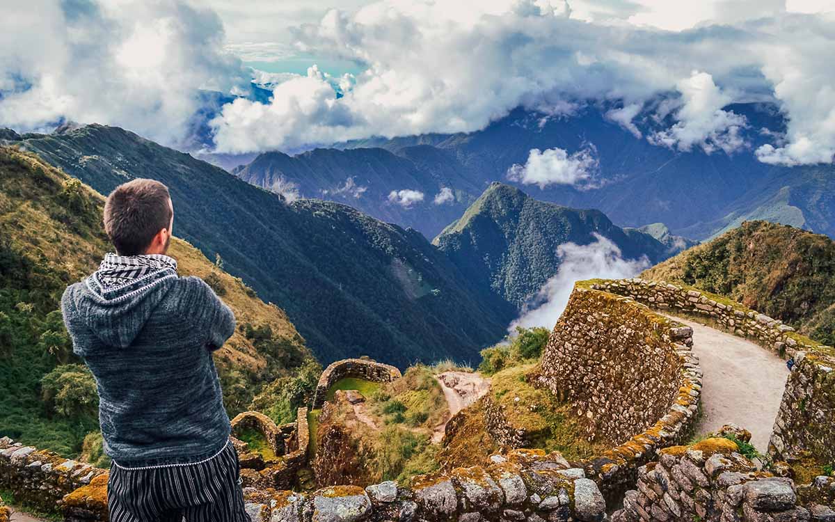
To reach Machu Picchu by walking, there are two popular routes that leave from the Cusco region. The classic Inca Trail, which covers 39 kilometers of paved path built by the Incas, spread over 4 days of trekking, is the only route that allows entering Machu Picchu through the Sun Gate (Inti Punku). The daily limit is 500 people, including guides and porters, so it is recommended to book several months in advance, especially between May and August.
On the other hand, there is also the Salkantay trek, the alternative for those who do not get a spot on the Inca Trail or prefer a route with no booking limit. This walk goes around the snowy Salkantay mountain, at 6,271 meters, and is usually finished in 4 or 5 days, ending in Aguas Calientes for the final climb to Machu Picchu by bus or on foot.
Main differences between both routes:
| Feature | Inca Trail | Salkantay |
|---|---|---|
| Duration | 4 days | 4-5 days |
| Spots | Daily limit (500 people, including staff); advance booking required | No limit of spots |
| Maximum height | Warmiwañusca, 4,215 m | Salkantay Pass, 4,650 m |
| Terrain | Original Inca stone path | Mountain path, with snow sections at the high pass |
| Arrival at Machu Picchu | Entry through the Sun Gate (Inti Punku) | Arrival at Aguas Calientes, going up by bus or on foot |
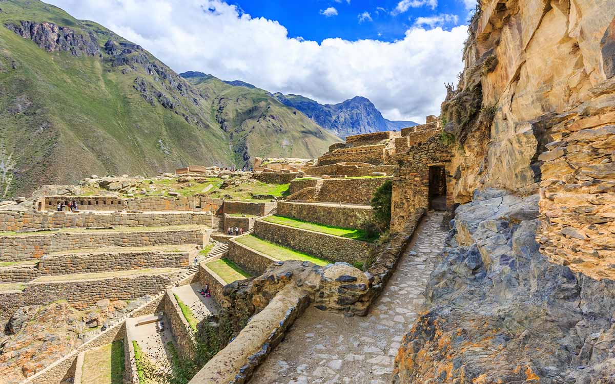
The Sacred Valley of the Incas stretches between Pisac and Ollantaytambo, following the course of the Urubamba River, at a lower altitude than Cusco, which makes it a frequent stop to get used to the altitude before continuing to Machu Picchu or the Inca Trail.
In Pisac there is an Inca archaeological site with farming terraces and a traditional craft market, open every day of the week. In Ollantaytambo an Inca fortress is preserved along with a city layout that has been lived in since Inca times, besides being the usual boarding point for the train to Aguas Calientes.
Other frequently visited spots inside the valley include the Maras salt mines, a group of more than 3,000 salt pools in use since pre-Hispanic times, and the Moray archaeological site, with stepped circular terraces whose exact purpose is still discussed among archaeologists.
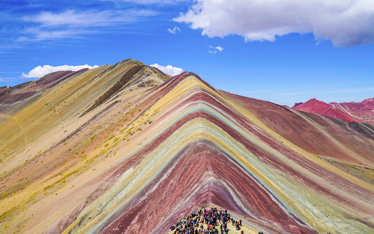
The Mountain of Colors, also known as Vinicunca, is a geological formation located in the Cusco region, at 5,036 meters above sea level. Its stripes of red, ocher, green, and lilac color are due to the mineral buildup gathered over millions of years, exposed by erosion and visible only for a little over a decade, when the melting snow left the hillside uncovered.
The usual access is on a one-day tour from Cusco, leaving early in the morning, about a 3-4 hour car ride to the starting point, and a 90 minute to 2 hour walk to the main viewpoint. Because of the altitude reached, it is recommended to have spent at least one day in Cusco to get used to the altitude before going up. There are also less crowded options near the same area, like Palcoyo and Pallay Punchu, with mountains of similar colors and fewer visitors.
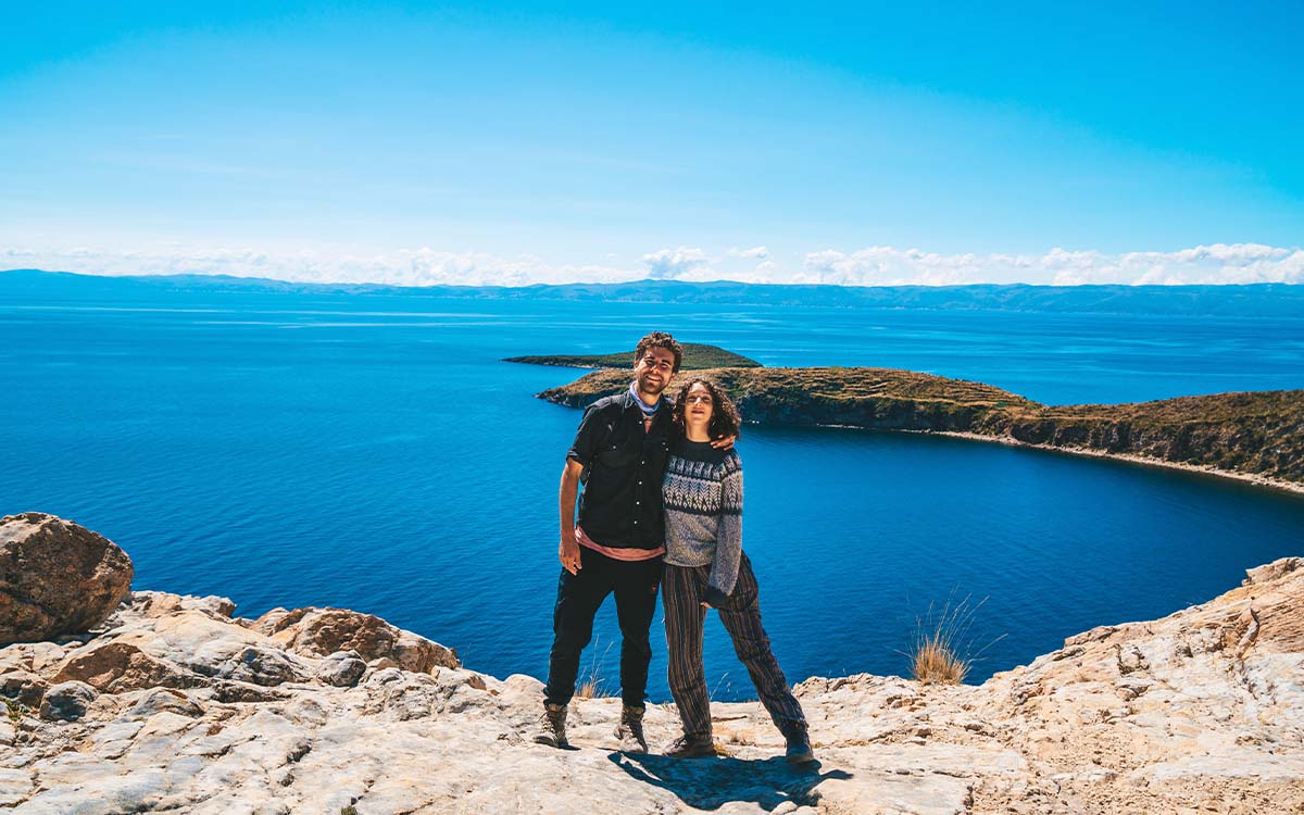
Lake Titicaca is the highest navigable lake in the world, at 3,812 meters above sea level, shared between Peru and Bolivia. Access from Peruvian territory is done through the city of Puno, located on its western shore.
The most common tours include the Uros floating islands, artificially built with totora, a water plant that is also used for the houses and boats of its people, and Taquile island, with people that keep a textile system declared Intangible Cultural Heritage of Humanity by UNESCO. Some operators also offer the option to spend the night in local family homes, mainly on Amantani island.
Puno is about 6-7 hours by road from Cusco, or you can get there by tourist train, taking about 10 hours of scenic travel through the high plateau.
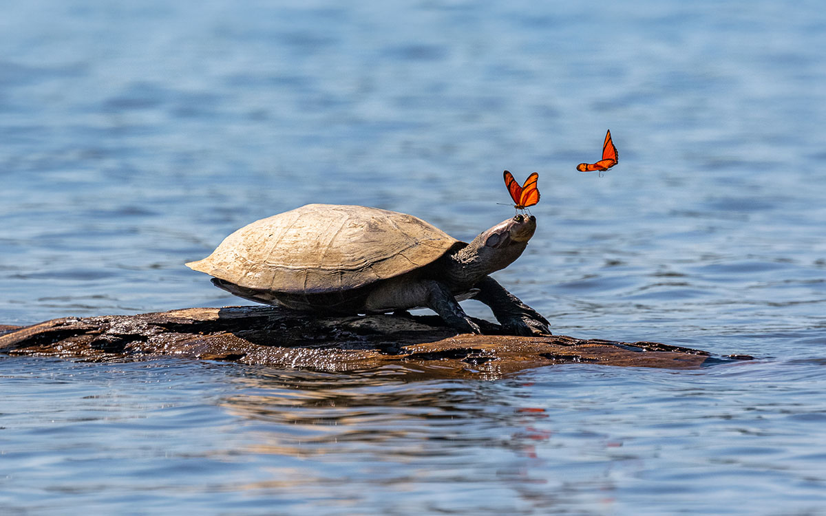
The Peruvian Amazon covers about 60% of the territory and has one of the greatest biodiversities on the planet. There are two main access points, each with different features of location and type of experience:
Other points to consider before choosing a destination would be the weather, it is warm and wet all year, with a season of less rain between May and September, better for wildlife viewing. Also, the lodges usually include guided night and day walks, boat trips for bird watching and, in some areas, a visit to clay licks (natural clay feeding spots for parrots and macaws).
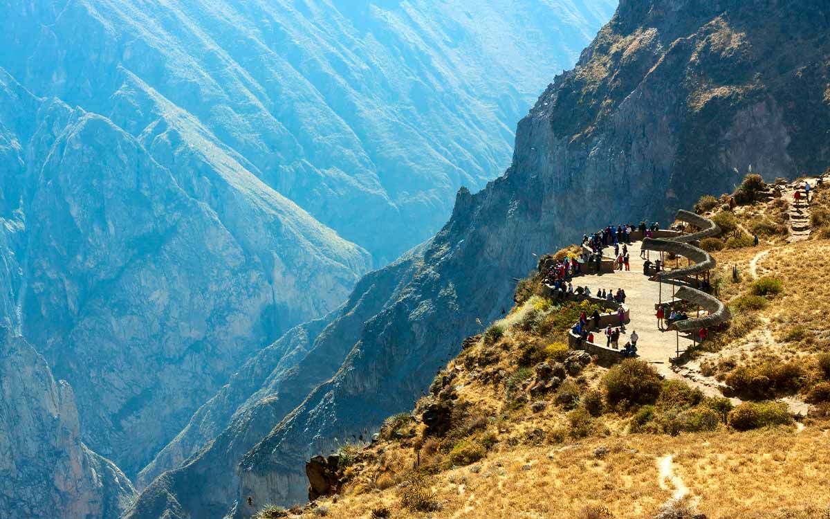
The Colca Canyon is located about 160 kilometers northwest of Arequipa and was declared by the Guinness Book of Records in 1986 as the deepest canyon in the world, with a depth that is twice that of the Grand Canyon of Colorado in the United States.
Main points on the trip to the Colca Canyon:
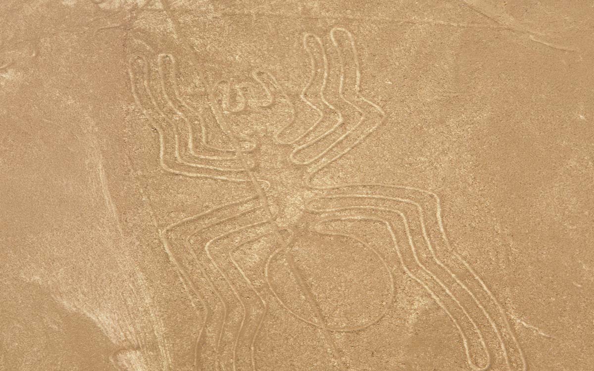
The Nazca Lines are a group of geoglyphs drawn on the coastal desert of southern Peru, between the cities of Nazca and Palpa, credited to the Nazca culture and dated roughly between 500 BC and 500 AD. They were declared a World Heritage Site by UNESCO in 1994.
The figures show animals, plants, and geometric shapes (including the hummingbird, the monkey, the spider, and the condor) and are only fully recognizable from the air, which is why the usual way to visit them is on a small plane flight lasting about 30 to 45 minutes. There is also a land viewpoint on the Pan-American Highway, from where two or three figures can be partially seen, as an option for those who prefer not to fly.
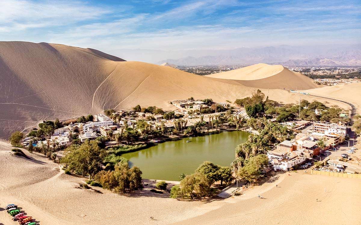
Huacachina is a natural oasis surrounded by dunes, located just outside the city of Ica, on the south coast of Peru. It was formed around a natural lagoon and today works as a small tourist town built around its edge.
Main points of the visit:
Peru does not have a single "best time" to visit, because its three geographical regions (coast, mountains, and jungle) have different weather patterns that are even opposite to each other. The ideal time depends more on which places you plan to visit than on a fixed date on the calendar.
The coastal weather works the other way around from the mountains: from December to March there is a season of sun and heat, ideal for visiting Huacachina and the southern beaches, while from June to September Lima is usually covered in drizzle and a gray sky, although this does not greatly affect activities in Nazca or Ica, which stay dry all year because of their desert weather.
The dry season goes from May to September, with clear skies and very little rain, which makes it the high season for the Inca Trail, Salkantay, and Machu Picchu in general. June, July, and August have the most visitors and the highest prices for lodging and tours, besides matching with the Inti Raymi (June 24). On the other hand, the rainy season goes from November to March, with February being the month with the most rain; in fact, the classic Inca Trail closes for maintenance during this whole month.
It also has two clear seasons: from May to September the river levels go down and the rain lessens, which makes walking and seeing wildlife on the shores easier; from December to March the rivers rise, which helps boat trips and reaching areas that are further from the water in the dry season.
| Region | Dry / high season | Rainy season |
|---|---|---|
| Coast | December - March (sun) | June - August (drizzle in Lima, does not affect Nazca/Ica) |
| Mountains | May - August | November - March (Inca Trail closed in February) |
| Jungle | May - August (low rivers) | December - March (high rivers) |
In general terms, those who look to combine the mountains and the jungle in the same trip usually find the best balance between weather and tourist crowds in the months of April, October, and November, right before or after the high season in Cusco.
-----------
The Peruvian Amazon covers some 60% of Peru, the Amazon jungle features on many people's itineraries - hardly surprising considering the variety of landscapes and wildlife that can be captured on camera. Lush vegetation, dense jungle, and waterways harbor millions of different species, alligators, and thousands of types of birds and fish. There are two main gateways into the heart of the Amazon: Iquitos in the north and Puerto Maldonado in the south, which is accessible from Cusco by air or road. From these two cities, visitors can explore the remote Pacaya - Samiria in the north, Peru's largest reserve, or visit the southern Amazon's Manu Biosphere Reserve, home to both macaws and parrots.
The former capital of the Inca Empire is a rapidly growing city, home of nearly 400,000 people. It lists several important attractions, among them ancient Inca walls and old colonial churches. It also hosts the annual Inti Raymi festival dedicated to the Inca sun god Inti.
The Inca Trail is the most famous trek in South America, combines beautiful mountain scenery, subtropical jungle, and a stunning mix of the Inca paving stones, ruins, and tunnels leading to the final destination Machu Picchu.
Declared the world's deepest canyon by the Guinness Book of Records in 1986, It's twice as deep as the Grand Canyon. The precipitous sides of the canyon, 100 miles northwest of Arequipa, are lined with terraces and picturesque villages, while the crystal clear waters of the Rio Colca flow through the valley far below. There are Andean condors in the air and herds of wild vicunas on the slopes.
This huge 4.2 million acre park has succesive tiers of vegetation rising from 500 ft. to 13,700 ft. above sea level. The tropical forest in the lower tiers is home to a unrivalled variety of animal and plant species. Some 850 types of birds have been identified and rarities such as the giant otter and the giant armadillo also find refuge there. Jaguars are often sighted in the park.
This is the highest mountain range of the Peruvian Andes. The Cordillera Blanca's total area is around 1,300 square miles; it's roughly 110 miles north-south and an average of 12 miles east-west.
Nevado Huascaran is the hightest peak at 22,205 ft.

 +51 84 217 551
 +51 997 434 941
 Av Tupac Amaru PP-10B, Santiago, Cusco, Peru
  info@incatrailmachu.com
 www.incatrailmachu.com


