


Choquequirao is an Inca citadel located in the district of Santa Teresa, in the Cusco region. What makes it so special? It is built on a mountain overlooking the Apurimac river canyon, it is part of the Vilcabamba complex, and it can only be visited by hiking. Today, Choquequirao Peru is one of the archaeological destinations that sparks the most interest among those looking for an alternative to the most famous routes in Cusco.
It is frequently called "the other Machu Picchu", but do they really look alike? They share the Inca architectural style, agricultural terraces, and an impressive mountain landscape. The difference lies in the access and the experience; Machu Picchu is reached by train and bus, while Choquequirao can only be accessed through a hike.
In this guide you will find the essentials to plan your trek to Choquequirao: its history, what to see in the citadel, how to get there from Cusco, the best time to go, and the difficulty level of the route. We will also review how it compares with Machu Picchu and what you should know about tickets and preparation, so you can decide if this hike is for you.
About the Choquequirao Archaeological Complex
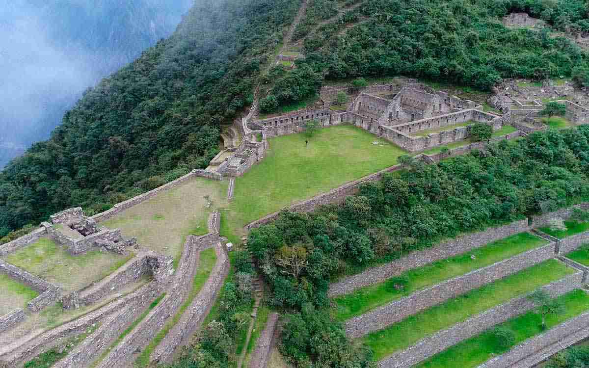
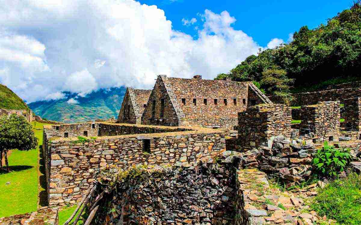
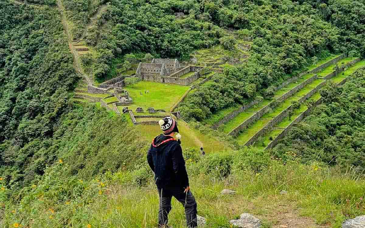
The complex spreads over the top and slopes of a mountain, and its structures are distributed across various sectors connected by paths and ancient stone steps. Among them, the main plaza, the agricultural terraces, the water channels, and groups of enclosures that, according to studies, had administrative, ceremonial and residential functions stand out.
But how much has been researched so far? Only a part of the site has been excavated and restored, and nearly 30 archaeological groups have been identified in the area, so knowledge about its function and exact time of construction continues to expand.
Location of Choquequirao
Choquequirao is located in the district of Santa Teresa, in the province of La Convención, Cusco region, on the left bank of the Apurimac river, within the Vilcabamba Valley. Although the site belongs to Cusco, the starting point of the trail is the community of Cachora, in the Apurimac region.

Its relationship with Vilcabamba is historical and geographical. It is believed that Choquequirao was part of the network of Inca settlements in that area, where the Incas took refuge during the resistance against the Spaniards. On the other hand, it also shares the link with that network of trails with Machu Picchu, although the specific function of Choquequirao within it is still debated among researchers.
Facts about Choquequirao
| Fact | Information |
|---|---|
| Location | Santa Teresa district, La Convención province, Cusco, Peru |
| Altitude | 3,033 m a.s.l. (Main square). Monumental sector ranges between 3,030 and 3,100 m a.s.l. |
| Extension | 1,810 hectares (archaeological center) / 522,878 hectares (Total protected area). |
| Walking distance | 44 km total (22 km each way) from the Capuliyoc viewpoint. |
| Duration | 4 days and 3 nights (classic round-trip itinerary). |
| Best time | From May to October (Dry season, sunny and rain-free days). |
| Difficulty | High, with steep descents and climbs |
| Access | On foot only. 4-hour road trip from Cusco to Capuliyoc, then trekking. |
History of Choquequirao
The history of Choquequirao combines documented facts with hypotheses that researchers still discuss today. To better understand the history, we will start with the key facts of this archaeological complex:
- Construction: 15th century (attributed to Pachacuti or Túpac Yupanqui)
- Probable function: Administrative, ceremonial, and agricultural center
- Context: Vilcabamba settlement network
- First written mentions: 18th century
- Studies and restoration: Since the 20th century, with work that continues
The Meaning of the Name
The name comes from the Quechua "chuqui k'iraw", which is usually translated as "Cradle of Gold". This is one of the most widespread interpretations, but it is not unanimous; some scholars translate chuqui as "lance" or "precious metal", so the exact meaning remains in debate. However, there is no evidence that the site was a gold-mining center, so the name is considered symbolic or of uncertain origin.
Origin and Construction of Choquequirao
It is believed that Choquequirao was built during the height of the Inca Empire in the 15th century. There is no written record indicating who ordered its construction, but there are two hypotheses to consider:
- Pachacuti (15th century): The most widespread. Some studies link it to a royal estate, similar to those attributed to this ruler in other areas of Cusco.
- Tupac Yupanqui: Pachacuti's successor, this is a hypothesis defended by other researchers.
Its strategic position over the Apurimac canyon, between the highlands and the jungle, suggests that it functioned as a key point to control routes to Vilcabamba and take advantage of the resources of different ecological zones.
Choquequirao and the Inca Resistance of Vilcabamba
Following the Spanish conquest, the Inca Manco Inca retreated in 1536 to the region of Vilcabamba, where an independent state was established. That resistance lasted until 1572, the year Tupac Amaru I, the last Inca of Vilcabamba, was captured and executed. It is worth noting that the main settlements associated with this period are Vitcos and Espiritu Pampa, connected to each other by ancient trails.
Rediscovery of Choquequirao
For centuries, the site was known to nearby communities and some travelers, until the first written references and explorations of the 18th and 19th centuries appeared.
| Year | Character | Contribution |
|---|---|---|
| 1768 | Cosme Bueno | Historian and cosmographer. Credited with the first public mention of the site. |
| 19th Century | Eugène de Sartiges | Visited the site and left records of his exploration. |
| 19th Century | Léonce Angrand | Prepared drawings and plans of the complex. |
| 1865 | Emilio Colpaert | Credited with the first layout of the trail from Cachora to the site within the map of Cusco. |
| 1909 | Hiram Bingham | Visited Choquequirao and recognized the importance of the structures. |
Bingham arrived at Machu Picchu in 1911 and maintained for years that this was the lost city of Vilcabamba. That theory caused Choquequirao to take a backseat in the studies of the time. Over time, this archaeological site went from being a little-studied place to a research and tourism development project. Among the most relevant milestones:
- Archaeological and restoration work: This has allowed the identification of nearly 30 archaeological groups and sections of the Inca Trail in the area.
- COPESCO intervention: The state plan included infrastructure projects and tourist circuits to benefit nearby communities.
- Multisectoral commission: Formed to coordinate the development of the site with criteria for conservation and control.
- Ecotourism: The stated goal is to increase tourism activity sustainably in the region.
What to See in Choquequirao?
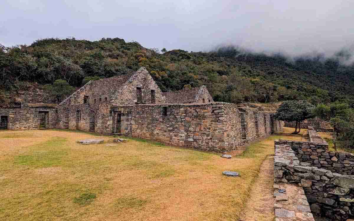
The complex is visited by sectors, and the full tour usually takes a good part of a day. Therefore, among the places to explore within the archaeological center of Choquequirao are:
- Main Square: This is the central space of the complex and serves as a reference point for orientation. Enclosures of various sizes are distributed around it, including structures that studies associate with administrative and ceremonial use. From here, you can access the other sectors.
- Ushnu and Ceremonial Sector: This is an elevated platform with an open view of the canyon and the mountains. In Inca architecture, the ushnu is related to ritual and political activities. It is a great spot for panoramic photographs.
- Agricultural Terraces: The terraces cover the slopes and are one of the most extensive works at the site. They served an agricultural function and also helped stabilize the terrain.
- Stone-Carved Llamas: This is the best-known attraction of the site. White stones forming figures of llamas were placed across a set of terraces. Their exact meaning is debated: some studies link them to rituals or the importance of livestock, but there is no confirmed explanation.
- Canals and Water Sources Sector: The site preserves canals, fountains, and irrigation systems that brought water from nearby streams to the terraces and domestic areas. They show how the Incas managed water in a mountainous area with steep slopes.
- Other Sectors:
> Residential and storage enclosure sets: Located at different levels of the site.
> Sectors under study: Nearly 30 archaeological groups have been identified in the area, and some are still under research.
How to Get to Choquequirao?
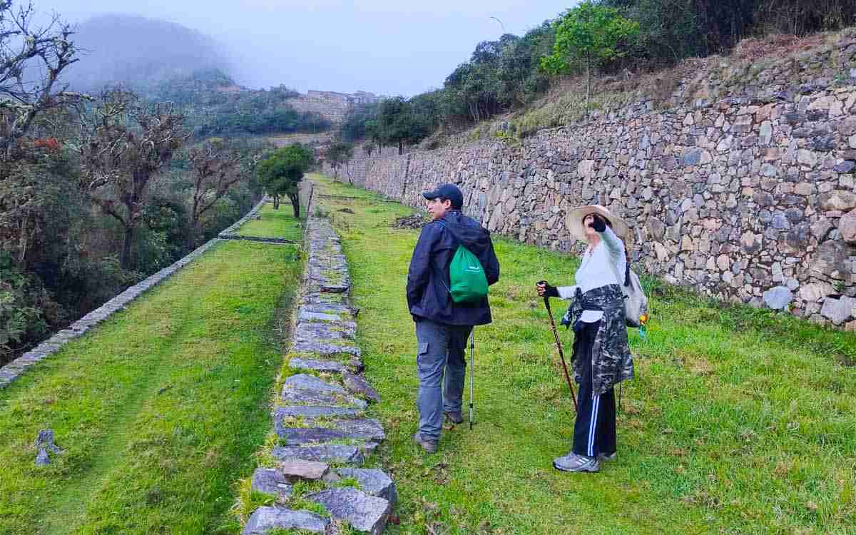
Choquequirao has no road access directly to the archaeological site. The usual route combines a vehicle ride from Cusco to the trailhead followed by trekking. It can be done with an agency or independently.
Key Facts of the Journey
- Trek starting point: Capuliyoc (community of San Pedro de Cachora, Apurimac)
- Modalities: With an agency or independently
- Usual duration: 4 days and 3 nights (round trip)
- Elevation change: Steep descent to the Apurimac River and subsequent climb up to the site
From Cusco to Cachora and Capuliyoc
The trip to reach the start of the trail is made by land heading west from the city of Cusco, following the road connecting to the Apurimac region:
- Section 1 | Cusco – Cachora: The journey starts by leaving Cusco toward the city of Abancay. The route proceeds along the main highway for about 3 to 4 hours, crossing Andean landscapes until reaching the point known as the Cachora Turnoff (Kilometer 154).
- Section 2 | From the Turnoff to the Capuliyoc Viewpoint: From this turnoff, the route leaves the main highway and enters a secondary road passing through the town of San Pedro de Cachora. The path continues climbing along a dirt track for an additional hour until reaching the Capuliyoc viewpoint.
This viewpoint is the final point for any vehicle and the place where travelers organize their backpacks, meet with muleteers, and begin the downhill hike toward the Apurimac canyon.
Choquequirao trekking route
Continuing with the journey to Choquequirao, the trail first descends to the Apurimac river and then climbs up to the site. These are the main points to pass during the tour:
| Point | Reference |
|---|---|
| Capuliyoc | Start of the hike and viewpoint. High point of the route, with the first view of the canyon. |
| Cocamasana and Chiquisca | Intermediate sections of the descent. Chiquisca is a common area for resting or staying overnight. |
| Playa Rosalina | Lowest point of the route, next to the Apurímac river. Warm climate. |
| Santa Rosa Baja | Camping area after crossing the river and starting the climb. |
| Marampata | Community and last section before the site. Frontal view of the citadel. |
| Choquequirao Citadel | Final destination of the hike. |
How the days are distributed (4-day itinerary)
- Day 1: Cusco – Capuliyoc and descent towards Chiquisca or Playa Rosalina.
- Day 2: Climb up to Marampata and arrival at the archaeological site.
- Day 3: Exploration of Choquequirao and return to an intermediate camp.
- Day 4: Final climb up to Capuliyoc and return to Cusco.
Tickets and permits for Choquequirao
Planning access to Choquequirao is much simpler and more flexible than in other destinations in Cusco, as it does not share the strict limitations of Machu Picchu:
- Official Rates: The general entrance ticket costs S/ 60.00 for national and foreign adults. University students get in for S/ 30.00 and minors for S/ 25.00. The ticket also includes the right to rest in the camping areas within the archaeological park.
- Points of Sale: Tickets are purchased exclusively in person and in cash (Peruvian soles) at the official ticket offices of the Decentralized Directorate of Culture of Cusco, located at the start of the trek in Capuliyoc or at the Chiquisca control post. It is essential to present the original identity document or passport.
- Reservations and Quotas: Unlike the classic Inca Trail or Machu Picchu, there is no daily quota limit or a digital booking platform. You can have complete certainty that you will find tickets available upon arrival at the site, regardless of the time of year.
- Visiting Hours: The archaeological complex is open to the public from 7:00 a.m. to 5:00 p.m.
- Low Influx: Due to its demanding physical access, Choquequirao is a highly exclusive destination that receives an average of barely 8,000 to 10,000 visitors a year. This guarantees a solitary and crowd-free experience, with an average that rarely exceeds 30 tourists per day.
Best time to visit and weather
Choquequirao has two distinct seasons, but the weather changes a lot along the route because the trail goes down to the Apurimac canyon and climbs back up. Therefore, it is wise to look at both the month and the section.
- Dry season (April to October): During these months rains are infrequent, days are warmer, and nights are colder. It is the recommended season for trekking, with clear skies and trails in better condition.
- Rainy season (November to March): With constant rains, the paths become slippery and dangerous between December and March. In 2026 entry to the park was temporarily suspended due to the safety conditions of this season.
Difficulty level and physical condition
Choquequirao is considered a demanding hike, but for a different reason than other routes; the difficulty does not come from the maximum altitude, but from the accumulated elevation change. You drop more than 1,000 m to the Apurimac river and then climb almost the same height up to Marampata and the site, with heat at the bottom of the canyon and cold in the upper part.
Facts about the Difficulty level
- Difficulty: From moderate to challenging
- Hardest section: The climb from Playa Rosalina to Marampata
- Altitude sickness: Lower than on other routes, because the highest point of the trek is close to 3,000 m
- Recommended duration: 4 days and 3 nights minimum
Comparison with the Inca Trail and Salkantay
| Aspect | Choquequirao | Inca Trail | Salkantay |
|---|---|---|---|
| Usual duration | 4 days | 4 days | 4 to 5 days |
| Highest point | 3,100 m a.s.l. | 4,215 m a.s.l. | 4,630 m a.s.l. |
| Main difficulty | Accumulated elevation change and heat | Altitude and stairs | Altitude and cold |
| Altitude sickness | Lower risk | Moderate risk | Higher risk |
| Influx | Very low | High | Medium - High |
In terms of total effort, many operators consider Choquequirao more demanding than the Inca Trail and Salkantay, although that assessment depends on each person. If you have already done other high-altitude routes, it does not mean this one is easier: here the fatigue comes from the repeated climbs and descents.
Recommended preparation
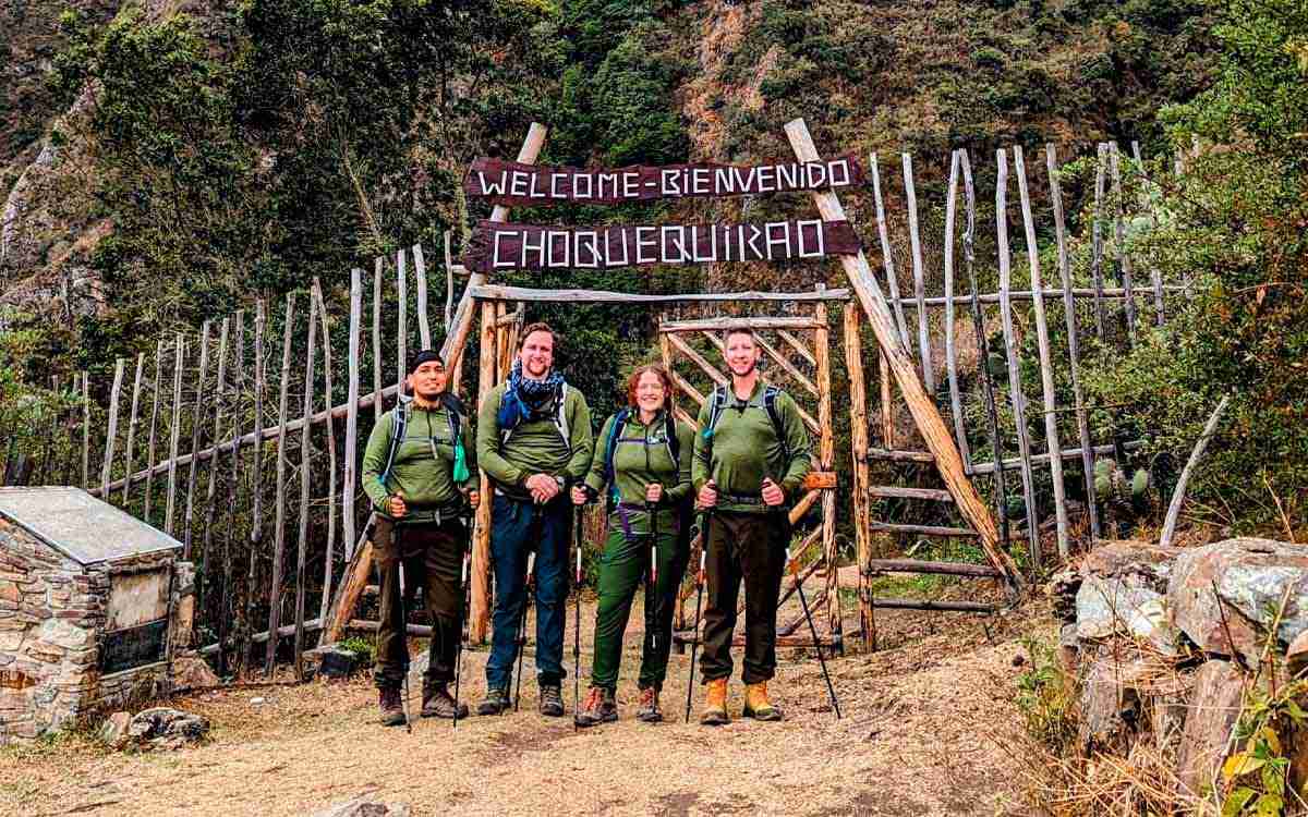
- Training: Long hikes with elevation change and, if possible, stairs or slopes with a backpack, for several weeks before the trip.
- Acclimatization: Although the altitude is lower, it is a good idea to spend at least one or two days in Cusco before starting.
- Descents: Trekking poles help on the long walk down to the river.
- Hydration: You lose a lot of fluid at the bottom of the canyon due to the heat.
- Pace: Set off early to do the climb before the hottest hours of the day.
Frequently asked questions
- How many days does the Choquequirao trek take?
The usual way is to do it in 4 days and 3 nights (round trip). Some operators offer 3, 4, and 5-day itineraries. Shorter options demand a faster pace and longer ones allow more time at the archaeological site. - Is it harder than Salkantay?
It depends on what is harder for you. Salkantay has a higher-altitude pass and more cold, while Choquequirao has lower altitude, but more accumulated elevation change, going all the way down to the Apurímac river and climbing back up to Marampata and the site. Many operators consider it more demanding in effort. - Can you go to Choquequirao without a guide?
Yes, it is possible to go on your own. To get to Capuliyoc you can take a bus to Abancay, get off at the turnoff to Cachora, and then take a shared taxi. Since you will not have logistical support, you will have to carry your food, camping gear, and organize your own stages. It is recommended only if you have trekking experience and good physical fitness. - Is there altitude sickness in Choquequirao?
The risk is lower than on other Cusco routes. Capuliyoc is at about 2,800 to 2,900 meters and the archaeological site at about 3,033 meters, so the highest point of the trek stays close to 3,000 meters. Even so, it is a good idea to spend one or two days in Cusco before starting. - When is the best time to go to Choquequirao?
The dry season, from April to October, is the recommended one. An operator's guide places the best weather between May and September. Between December and March, rains make the trails slippery, so always check the official status of the route before traveling. - How much does the entrance to Choquequirao cost?
The reference rate for general admission is S/ 60, and the purchase is made in person at the Capuliyoc checkpoint, with cash in soles and an identity document or passport. If you hire an agency, it is normally already included in the package.


 +51 84 217 551
 +51 997 434 941
 Av Tupac Amaru PP-10B, Santiago, Cusco, Peru

